
Research Overview
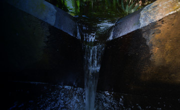
What does water reveal about tropical landscapes?
By studying hydrology and biogeochemistry of natural and human-altered landscapes in the Americas, Southeast Asia and Africa, I contribute to new concepts integrating atmospheric and terrestrial processes and the role of people as ecosystem shapers.
How do exceptional phenomena—giant storms to wildfires to volcanic eruptions—affect river composition and flow?
Any process that alters most of a landscape, from construction, to agriculture, to fire alter the way that landscape processes water from rain or snowmelt. These processes usually increase vulnerability to erosion, and a giant storm is able to generate more runoff and mobilize massive amounts of sediment, more than would have been mobilized under its former land cover. The very largest storms, however, can even break through the natural protections afforded by intact land cover, and great erosion can result. Volcanoes are another story. They make their own landscapes, by providing vast quantities of new, abiologic, loose material, by melting summit snow and glaciers to make raging torrents, and by creating their own weather. Rivers become debris flows and lahars; valleys and towns are buried. With the larger eruptions, former landscapes are gone and new cycles of land-cover development, weathering, and erosion must begin again; Krakatao is a famous example.
Are there rules of thumb to reliably assess watershed processes?
An experienced hydrologist or biogeochemist thinks with rules of thumb. How does a new watershed resemble ones that have been previously witnessed and measured in detail? Is this a flatland or a steepland? Is the water turbid? What do quick measurements such as pH and conductivity reveal about the weathering? Today, remote sensing is a fantastic tool, enabling the hydrologist or biogeochemist to develop a three dimensional view of the landscape and upstream land cover to better put a watershed into context. Complicated chemical measurement and hydrologic modeling can then be invoked to refine an analysis, but these are time consuming and expensive. The best field hydrologists and biogeochemists are often those who have studied the most landscapes in the field.
Can we provide inexpensive data for evaluating landscape conservation and mitigation of human impact?
In today’s world, the least expensive data to access and use is often remote sensing – satellite images and digital elevation models. These can be used to put a landscape in context. Basic hydrologic monitoring (rainfall, stream discharge, and basic meteorological data) is essential, and water-quality monitoring (temperature, conductivity, pH, and suspended sediment) incrementally adds to an understanding of human impacts and mitigation work. An in-depth understanding (what, where, when, why, and who?), gained through chemical analyses of sediment, major constituents, nutrients, trace elements, and pesticides can range from relatively inexpensive – a few strategic samples, with sample collection guided by experience elsewhere – to expensive – comprehensive forensic studies.
Can understanding erosion and its coupling to the water cycle inform us about the history of the planet?
Yes, and this has been a life’s interest for me. The Earth’s history is recorded in sedimentary rocks, rocks that have been deposited in the Earth’s surface environment, either under liquid water, air, or ice. There are three major flavors: clastic (deposited as particles), chemical (chemically or biologically precipitated out of material that was in solution), and organic (the accumulated soft parts of plants). Each of these classes of sediments records information about its history of erosion, transport (dispersal), and deposition. Fossils contained within these sediments provides considerable additional information. I am particularly interested in clastic sediments because the first step in their formation is erosion, and this is in turn controlled largely by bedrock composition, topographic relief (flat versus steep), temperature (cold, warm), moisture supply (limited, rain, snow, ice), and land cover. Sorting these controls is one of the enduring themes of my research.
Education
1970-1974, Massachusetts Institute of Technology, B.S. Earth and Planetary Sciences, emphasis in Planetary Physics and Chemistry.
1975-1980, Massachusetts Institute of Technology - Woods Hole Oceanographic Institution Joint Program in Oceanography, Ph.D., emphasis in Chemical Oceanography, with a thesis entitled "Major Element Geochemistry of the Amazon River System."
1980-1981, USGS-GD-Office of Marine Geology, Woods Hole, MA, National Research Council Post Doctoral Fellowship, research project on clay mineralogy.
Selected Publications
Stallard, R.F., and Murphy, S.F., 2013, A unified assessment of hydrological and biogeochemical responses in research watersheds in eastern Puerto Rico using runoff-concentration relations: Aquatic Chemistry, in press.
Ogden, F.L., and Stallard, R.F., 2013, Land use effects on ecosystem service provisioning in tropical watersheds, still an important unsolved problem. Proceedings of the National Academy of Sciences, Digital Comment, in press.
Ogden, F.L., Crouch, T.D., Stallard, R.F., and Hall, J.S., 2013, Effect of land cover and use on dry-season river runoff, runoff efficiency and peak storm runoff in the seasonal tropics of central Panama: Water Resources Research, in press.
Coates, A.G., and Stallard R.F., 2013, How old is the Isthmus of Panama? Bulletin of Marine Science, v. 89, n. 3 p.000-000. http://dx.doi.org/10.5343/bms.2012.1076.
Stallard, R.F., 2012, Geology, hydrology, and soils, in Pitman, N., Ruelas I., E., Alvira, D., Vriesendorp, C., Moskovits, D.K., del Campo, Á., Wachter, T., Stotz, D.F., Noningo S., S., Tuesta C., and Smith, R.C., Perú: Cerros de Kampankis: Chicago, Illinois, The Field Museum, Rapid Biological and Social Inventories Report 24, p. 233-242, 318-319, 452 p. [also in Spanish: Geología, hidrología y suelos, p. 76-86, 318-319].
Stallard, R.F., and Murphy, S.F., 2012, Water quality and mass transport in four watersheds in eastern Puerto Rico—Chapter E, in Murphy, S.F., and Stallard, R.F., Editors, Water quality and landscape processes of four watersheds in eastern Puerto Rico: Reston, VA, U. S. Geological Survey, USGS Professional Paper 1789–E, p. 113-152, 292 p. http://pubs.usgs.gov/pp/1789/pdfs/ChapterE.pdf.
Stallard, R.F., 2012, Weathering, landscape equilibrium, and carbon in four watersheds in eastern Puerto Rico—Chapter H, in Murphy, S.F., and Stallard, R.F. , Editors, Water quality and landscape processes of four watersheds in eastern Puerto Rico: Reston, VA, U. S. Geological Survey, USGS Professional Paper 1789–H, p. 199-248, 292 p. http://pubs.usgs.gov/pp/1789/pdfs/ChapterH.pdf.
Stallard, R.F., 2012, Atmospheric inputs to watersheds of the Luquillo Mountains in eastern Puerto Rico—Chapter D, in Murphy, S.F., and Stallard, R.F., Editors, Water quality and landscape processes of four watersheds in eastern Puerto Rico: Reston, VA, U. S. Geological Survey, USGS Professional Paper 1789–D, p. 85-112, 292 p. http://pubs.usgs.gov/pp/1789/pdfs/ChapterD.pdf.
Stallard, R.F., 2011, Landscape processes: geology, hydrology, and soils, in Pitman, N., Vriesendorp, C., Moskovits, D.K., von May, R., Alvira, D., Wachter, T., Stotz, D.F., and del Campo, Á., editors, Perú: Yaguas-Cotuhé: Chicago, Illinois, The Field Museum, Rapid Biological and Social Inventories Report 23, p. 199-210, 272-275, 376 pages. [also in Spanish: Procesos paisajísticos: geología, hidrología y suelos, p. 72-86, 272-275].
Stallard, R.F., Ogden, F.L., Elsenbeer, H., and Hall, J., 2010, Panama Canal Watershed Experiment: Agua Salud Project: Water Resources Impact, v. 12, no. 4, p. 17-20.
Ogden, F.L., Stallard, R.F., Elsenbeer, H., and Hall, J., 2010, Panama Canal Watershed Experiment - Agua Salud Project, in Tarté, A., Soto, E.R., and Messina, E.A., editors, Second International Symposium on Building Knowledge Bridges for a Sustainable Water Future: Panama, Republic of Panama, Panama Canal Authority and UNESCO, p. 168-172.
Stallard, R. F., 1998, Terrestrial sedimentation and the carbon cycle: Coupling weathering and erosion to carbon burial: Global Biogeochemical Cycles, v. 12, no. 2, p. 231-252.
Stallard, R. F., 1995, Relating chemical and physical erosion: in White, A.F., and Brantley, S.L. eds., Chemical Weathering Rates of Silicate Minerals: Reviews in Mineralogy, v. 31, p.543-564.